
WATERLOO NETWORK WALK 2
CLAPHAM JUNCTION walk to BARNES
3 hours
The train line was opened in 1846. At the time, the station in Clapham Junction did not exist and trains ran through the location of the present station to a terminus in Nine Elms.
Routing note: This walk connects in Clapham Junction with Waterloo walks 1 and (less conveniently) 10, with Victoria train networks walk 12, and with London Overground walks 1 and (more conveniently) 9. It connects in Barnes with Waterloo walks 3 and 5.
CLAPHAM JUNCTION

Clapham Junction station north entrance
This station is the busiest in the whole of Britain in terms of trains per day and in termes of passengers changing trains.
Two train lines were built passing the site of the present station in 1838 (towards Wimbledon) and 1846 (towards Richmond). These lines ran originally towards Waterloo (with the original terminal at Nine Elms) and the junction towards Victoria station (with the original terminal called Pimlico but located on the south bank of the Thames) opened in 1858. A train line towards Kensington Olympia opened then in 1863 although services were suspended for shorter periods of time later on. Finally, an older but unused junction towards Wandsworth Road is in use since 2012 for trains linking Clapham Junction with Peckham.
The station itself opened in 1863 because it was the terminal for the Kensington service. The name of the station is a bit dishonest as it is much closer to Battersea than to Clapham, but Battersea was rather industrial in the 19th century while Clapham was more elegant. Train companies chose the name Clapham Junction in order to reassure clients about the type of passengers they might encounter while changing trains.
The layout of the station is a bit confusing as it is to a large extent a transfer rather than a neighbourhood station. The platforms are aligned in two groups at an angle of 30% corresponding to the two original train lines towards Wandsworth Common and towards Wandsworth Town. Nearly all train platforms are connected by a covered footbridge while the platform towards Kensington is only connected via the underground hall. The hall tends to be gloomy and is overcrowded at rush hour because it gives direct access to the station exits, north towards Battersea Park and south towards the main road. The south exit goes through a mini-shopping centre which somehow does not fit with such an important station.
There were obviously large station buildings but they are not apparent from the underground hall. I am very sorry I completely forgot to take a picture of the actual old entrance, located at the south end of the footbridge on St John’s Hill. My excuse is that I try not to take pictures with people on them in order to avoid impeging on their personal rights – and this is outstandingly difficult in such a busy station. My picture shows the northern exit, which is the one you use anyway.
Exit the station via the North exit (near the London Overground platforms)
L Grant Road
Ahead Tours Passage, a footpath along the train embankment

Part of Winstanley Estate
The passage used to have a bad reputation because it skirts a large housing estate, Winstanley Estate. The housing towers on my picture were built together with a series of lower buildings to house the local residents when the Council decided after World War II that the existing Victorian tenements were unfit for further use. Architects thought that people would be happy about the modern conveniences in the new flats and that towers made it much easier to have large green spaces around the buildings.

Tours Passage
What they could not expect is that Britain would lose most of its industrial jobs in the 1970s and that many residents of such estates would lose their jobs. Young people growing up with no chance of a reasonable job are a recipe for serious problems and Winstanley Estate became notorious for criminal activities. There was serious rioting here in 2011. The Council plans to demolish the estate and achieve a more balanced set of residents in the future in the replacement buildings. You do not need to feel uncomfortable about the passage as it is now under CCTV surveillance.

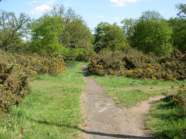
Usk Road open space
Towards the end of the passage, the landscape turns greener as there is an open space with trees between the suburban houses. It seems the open space is heavily used as not much grass is able to grow.
At the end R Petergate
L Eltringham Street
Cross the subway under the roundabout, taking the exit near the train tracks

Wandsworth Bridge roundabout
This huge roundabout at one end of Wandsworth Bridge gives you an opportunity to see a large contemporary development set along the Thames. It is interesting to see how such buildings with luxury flats pile about as many people as the council estate you saw before with less green space – but are more sought after. My picture is taken from the other side of the Thames and shows mainly the blocks of flats just upstream of the bridge, but you get a glimpse at the far left of the blocks downstream. They are similar in style and price level.

Wandsworth developments seen from the North bank

Niemeyer sculpture on Wandsworth roundabout
In the middle of the roundabout, there is a large steel structure that a local gentleman says on his blog has been designed by world-famous Brazilian architect Oscar Niemeyer. This is possible as Niemeyer is known for extremely conceptual works using modern materials (he is particularly well known for designing the new Brazilian capital at Brasilia). But I still have doubts as I find it hard to imagine that a work by such a celebrity can be defiled by very uninspiring advertising, as my picture shows.
Ahead along the open space

Small park off Wandsworth Bridge Roundabout
The open space was planned when the borough decided in the 1960s to adapt local roads to modern car traffic. This involved a dual carriageway between Wandsworth Bridge and Tooting and crowning it with a huge roundabout. The space not needed for traffic was left open with some hardy planting tolerant of the pollution level. By the way, my route does not go near the bridge itself because it is the ugliest one in London, a plain steel structure from 1940 painted in weird baby blue.
L Old York Road crossing under the train line and passing
WANDSWORTH TOWN

Wandsworth Town station
I was unable to find out when the station was opened. The layout makes it perfectly possible that the station would have been opened together with the train line in 1846.
As the concourse is located under the arches of the train viaduct, there is no station building to speak of. The entrance from the street is marked by a somewhat peculiar neo-classical structure painted in lively colours that looks like a scheme from the 1990s. It was fashionable at the time to give the overall impression of clacissism, here through columns and a triangular pediment, while showing the contemporary materials, here concrete. Decoration and ornaments were eschewed, partly in order to save costs, partly because it was considered dishonest to hide unnecessarily the type of material used.
Ahead Old York Road

Wandsworth Town Hal
At the end of Old York Road, you can go on a short detour along Fairfield Street to see Wandsworth Town Hall. It is typical for the municipal buildings built in the 1930s when a 1933 law gave the metropolitan boroughs additional powers. The Wandsworth town hall was finished in 1937 and is rather majestic, stressing vertical lines like a royal palace rather than horizontal lines (as was done in Dagenham or Walthamstow). The lower level has a sort of rustico treatment in order to avoid plain concrete, imitating Renaissance palaces from Italy. This was a bit unusual in the 1930s.

South front of Wandsworth Town Hall
The side view (I think it is the South front) with the small flower beds has a long frieze of sculptures over the windows showing local history, a very popular decoration theme for a town hall at the time. The style is typically Art Deco but I don’t think that the artist was a major plastician because the silhouettes of the people in the sculptures are quite static.

Detail of decoration
Go back to the end of Old York Road and take now Armoury Way (L when coming from the town hall)
Cross the River Wandle

River Wandle in Wandsworth
The river is not very big, being only 14 km long, but is well worth remembering for the River Wandle Trail, a walking and cycling path following most of the course of the river all the way to Croydon. It is the most pleasant manner of linking the Thames Path with the southern suburbs and I used it on numerous occasions on my walking routes. The best sections are upstream of Colliers Wood, so quite far away from Wandsworth.
In Wandsworth, the river mouth provided primarily convenient landing places for industrial activities using river transportation, so that it is not the prettiest section. From the bridge, you have an interesting view towards Wandsworth Bridge with the new luxury developments I mentioned before.

Wandsworth Bridge from Thames Path
R The Causeway, walking along the river
Just before the next bridge over the river, you will find signposts for the Thames Path. Take the marked path L towards Putney Bridge
The Thames Path leads across a second arm of the River Wandle, then back to the Thames.

Development near Wandsworth pier
You walk here underneath blocks of luxury flats built on old industrial premises. Independently of what you might think of London becoming too expensive for normal people to buy a flat, such riverside blocks do have the advantage that they reclaim the waterside for the Thames Path. From the path, you can see on the other side of the river a large green space. It is one of the few large private parks directly along the river and belongs to Hurlingham Sports Club, where you cannot go and walk around.

Hurlingham club grounds from south bank
Conveniently for the luxury flats, there is a boat pier just nearby. I saw a very impressive house boat moored nearby. Instead of being a converted means of transportation, it is a floating architect fantasy. The owner obviously has nothing to fear from passers-by as he does not use curtains, but I can imagine he/she does not watch TV at night wearing a bathrobe.

Transparent houseboat
The Thames Path passes a road called Point Pleasant. There is a very elegant neo-classical house at the corner. I am not sure it is indeed from the 1820s and I found no details about its original use, but it is an excellent imitation if it is not an original. The column tops in particular are very Adam-esque. On the small square in front of the house, the armillary sphere out of iron is an obvious reminder of shipping.

Mansion in Point Pleasant
The Thames Path then soon reaches Wandsworth Park.

Plane trees in Wandsworth Park
This park was originally agricultural land, bought by the council in 1898. It has a rather plain design, being originally flat, muddy land, but it is listed because of the row of trees along the river. You have a good view from here of the headquarters of Hurlingham Sports Club, a Georgian mansion. The club is highly exclusive and stands under the patronage of the Duke of Edinburgh.

Hurlingham Club building from south bank

Pygmalion sculpture in Wandsworth Park
There is a small area of formal flower beds in Wandsworth Park, but I keep it for an other route. What you will see instead near the riverside is two bronze sculptures by influential English sculptor Alan Thornhill, who lives nearby. He started as a potter as a young man, but got frustrated at repeating the same gestures all the time.
Cross the park along the Thames Path. At the park exit
L Deodar Road (you leave temporarily the Thames Path)
Cross the main road into Bective Road
After the tennis courts R Disraeli Road

Putney Art School
At the corner with Oxford Road, you walk past the Putney School of Art and Design, an institution founded in 1883. The building has the typical high windows needed in Victorian times to provide light to teaching studios.

Violet Villa in Disraeli Road
Further along Disreali Road, you walk past Violet Villa. The very unusual façade uses lots of curving shapes, e.g. for the garden railings and the balcony. That it looks so unusual is due to the fact that it was built by a German designer who had been influenced by the Jugendstil movement. This style stresses natural, flowing shapes and decoration inspired by nature (such as the smiling sun on the pediment), reacting against the sculptural bombast popular at the time. I read that the mosaic with a dancer is not original although it fits. The balcony is very unusual for London as a large balcony makes little sense when you have a garden. The house would also probably not have been painted in white as it is called “Violet Villa”.

Old Putney Library
A little further on, you walk past the former Putney library, a good example of Edwardian bombast the Violet Villa owner found distateful. Lots of sculptural elements reminiscent of French castles, making a plain library an imposing building, and a generous mix of unnecessary decoration elements like a coat of arms on the pediment where you hardly see them from the street level. One good idea in Edwardian times if the red-and-white colour scheme of walls as Victorian buildings could look very drab, particularly after pollution covered them in soot.

Putney library extension
The new library building adjoining the old one is clean and looks convenient, but it does not look very special. You have to go to Peckham to see a really exceptional public library.
PUTNEY

Putney station
The station opened in 1846 together with the train line.
The station building was replaced in 1885. It is a rather unimpressive elongated brick construction with lots of entrance arches. Interestingly enough, there are no two station buildings with the same architecture on this train line, whereas some train companies were very keen on reusing standard schemes (partly in order to save costs, partly as a sort of branding policy).
R Putney High Street

Shopping Centre on Putney High Street
The first conspicuous building you walk past on High Street is a shopping centre built in 1990. The style is rather typical of the 1990s, drawing heavily on neo-classical elements like columns but with simplified (i.e. cheaper) shapes and clear strong colour contrasts. Seen from the side like on my picture, it reminds me strangely of some religious venue with a crown of thorns and above it a huge cross. Either this is a subliminal message by the developer / architect / owner or it is just by chance.

Putney parish church
The real religious building, the parish church, is a little bit further down the street. The oldest part is the tower, a genuine medieval item. The rest of the church was rebuilt in the 19th century and the decoration inside is from the 1980s due to arson in 1973. I was unable to enter the church but the website shows a chapel from the 16th century with an interesting ceiling in perpendicular gothic style. It also shows an unusual sense of space as a flat ceiling was introduced in the 1980s instead of the more usual Victorian vaulted ceiling.
L Felsham Road
At the church R Footpath towards the River Thames

Putney Bridge
You exit the path just upstream of Putney Bridge, first built in 1729 to replace a busy ferry because delays with the ferry inconvenienced V.I.P.s including His Majesty the King who had been delayed when coming back from a hunt. The current bridge was built in 1886 following an accident of a barge with the previous one and was built directly out of very sturdy granite from Cornwall.

Putney Bridge on a windless day
There was a scandal in 2007 when a shameless developer damaged part of the bridge in order to make construction of a block of luxury flats easier. My picture with the perfectly still water shows the offending development along with the parish church.

Curving restaurant called The Square
On the Putney side of the river, you cannot help but notice the unusual shape of a restaurant. It is built so as to remind you a little of the prow of a boat, but this does not fit well with the brand name “Thai Square”.
L along the Thames, following again the signposted Thames Path on Putney Embankment

Pub with grand façade on Putney Embankment
The town houses at the beginning of Richmond Road are rather impressive, with a huge pub built into the ground level. The style looks like an Edwardian version of neo-Georgian with the kind of half-naked beings gentlemen loved looking at around 1900. The pub entrance with its red carpet lies between a mermaid and a river god.

Art déco boathouse
Very soon, the town houses give way to a much more relaxed atmosphere with a row of boathouses. One of them has an interesting Art Déco design with the typical cornices full of right angles. Patterns reminiscent of natural designs were also in fashion, here with a wavy pattern to remind you of the ripple in water caused by rowing. Rowing is very important in Putney because it is traditionally the starting point of the famous Oxford vs. Cambridge race. The teams race from Putney to Mortlake, a little longer than you will be walking on my route.
Continue along the Thames Path for about 2 miles, crossing under Hammersmith Bridge

Leaders Gardens
At the end of the paved stretch leaving Putney, you walk past Leader’s Gardens. This local park was opened in 1903 on the site of an open space where boat builders and rowers put boats into the river. I don’t know where the unusual name comes from. The park has nice trees but is otherwise not special.

View from Putney Embankment
Opposite the park on the North bank of the river Thames, you can see a large, rather ugly white wall. It is the back wall of the tribune for Craven Cottage stadium where the resident club is Fulham F.C. The grounds are rather small by modern standards because the 1905 design is listed.

Barn Elms School Sports Centre
There is a long, quiet stretch of the Thames Path because it is sandwiched between the river and large fenced areas, first school sports grounds and later the so-called London Wetland Centre. As the latter is not accessible from the riverside, I keep it for an other route.

Development in former Harrods Wharf
When housing begins to appear again, you very soon reach a large development called Harrods Wharf. It is very interesting to compare my two pictures of the riverside building: the south-facing façade has plenty of large balconies and glass walls while the north-facing façade towards the river has a rather forbidding, institutional look with neo-classical shapes.

Former Harrods depository
The listed building dates back to 1904, when the famous warehouse company Harrods decided to buy a large new building as its “furniture depository”. It was not meant to be visited by clients under normal circumstances, but many people travelled by boat and such an imposing building was a sort of advertising method. The Depository was just a storage hall. I am not sure, but I can imagine clients could pay Harrods to store some of their furniture while for example being posted overseas and this would also justify a reassuringly stately building.

Fulham developments from south bank
Despite approaching and then crossing under Hammersmith Bridge, the south bank where you are reminds quiet and leafy as the only buildings close to the water side are schools with large sports grounds between them. The other bank has a large and interesting variety of buildings. They are too far away to comment on individual houses, but the overall view is really nice. Downstream of the bridge, new blocks of luxury flats dominate the landscape. Each development taken by itself is rather massive but the combination is not ugly as you need the large scale considering the distance from your viewpoint.

Hammersmith Bridge
The first Hammersmith bridge was built in 1824 as a chain-link suspension bridge. This was very innovative but the chains could only carry a limited weight so that most such bridges were replaced later in the 19th century (the well-known bridge in Budapest was built later and incorporated reinforcements). The present bridge was built in 1887. It is now somewhat tired and cannot be used by heavy traffic, but it is listed and was even repainted in its original dark green colour in 2000. Its shape and colour make it a remarkable landmark that I always enjoyed crossing by bicycle.

Hammersmith from south bank

Chiswick Mall from south bank
Upstream of the bridge, the North bank is a long row of low villas. This is obviously a protected area as speculators would otherwise have built large developments. On the south bank, there was no construction for a long time because it was a private estate bought in 1691 by a French gentleman who had been forced to flee France, king Louis XIV having expelled all huguenots (the French calvinists). The gentleman was named the baron of Castelnau and this explains why a suburb of London got a French name.

Thames Path in Castelnau

Leg of Mutton Nature Reserve
After a last school, the Thames path runs between the river and a lake. The Leg of Mutton Reservoir is a nature reserve and there is a path around it with two entrances from the Thames Path if you want to watch birds.
Shortly before the Barnes railway bridge, the Thames Path passes Small Profit Dock Gardens and joins Lonsdale Road.

Small Profit Dock Gardens
The gardens are not really a park, just a strip of greenery, but they needed a separate name because they are managed by the borough as a public open space. The name is delightful though.
L Barnes High Street

Pub in Barnes High Street
One of the most conspicuous buildings on High Street is a pub called the Bull’s Head. It has a roof turret and a balustrade reminiscent of French châteaux. There was a pub here as early as 1649 but the present building is from 1845. It was a well-known venue for jazz concerts at a time when these often took place in suburban pubs.
R Station Road
The road runs nearly all the time along open spaces (first a pond, then the churchyard, then Barnes Common). Don’t hesitate to leave the road as long as you keep the direction. This section of the walk taught me the difference between a green and a common: Barnes Green is mowed so that it can be used for informal football and leisure while Barnes Common is wooded.

Pond on Barnes Green

Barnes Green
Barnes Common (western section)

Barnes Common near the station
The road ends at
BARNES

Barnes station
The station opened in 1846 together with the train line.
The station building is the original one. It is a highly unusual building for a train station, much taller with much more pointed roofs than you would expect. The main façade, made of red bricks, also incorporates a chequered design in black like Tudor palaces. This led to the style being described as “Tudoresque Gothicism”.
The train company board discussed such detailed design issues as the type of chimneys, that were to be in a style fitting with the rest. There is apparently no information available about the architect, who also designed two other, much smaller stations on the same train line. Those two were replaced later on.

Violet villa, 51 disraeli rd, was our family home in the past, in fact my sister and I were born there,me in 1952 my sister later. The facade should be painted Violet and the mosaic is an awful addition, recently added. The inside is amazing. The house must have been built around the huge mirror inside the front door which is floor to ceiling and the length of the hall. The lounge ceiling is painted with Angels and all the doors with brown paint are of various ladies. Wonderful staircase. The German artistic designer had a stone built art studio at the bottom of the garden, now a seating area I believe. I went to Brandlehow school and my older brother wandsworth Grammar. We left to live in Ealing when I was 6 and I GOT RIBBED TERRIBLY FOR MY POSH PUTNEY ACCENT. The rest of the family stayed on. The re developers destroyed portraits at the top of the stairs by WASHING THEM, I THINK THE ORIGINAL MOSAIC HALL FLOOR IS THERE
AND THE DEVELOPERS TOOK AWAY A HUGE GLASS CABINET FULL OF VICTORIAN STUFFED ANIMALS. I only know these things because the present owners let me look around one day. The Sun sign is for the fire service to stop it showed one was insured. The front wall is not original.
Thank you for these very interesting détails. It definitely helps understand why the building looks as it does now.